Murasu
This system is still being tracked - see the Active Systems page for the latest position, forecast and status.
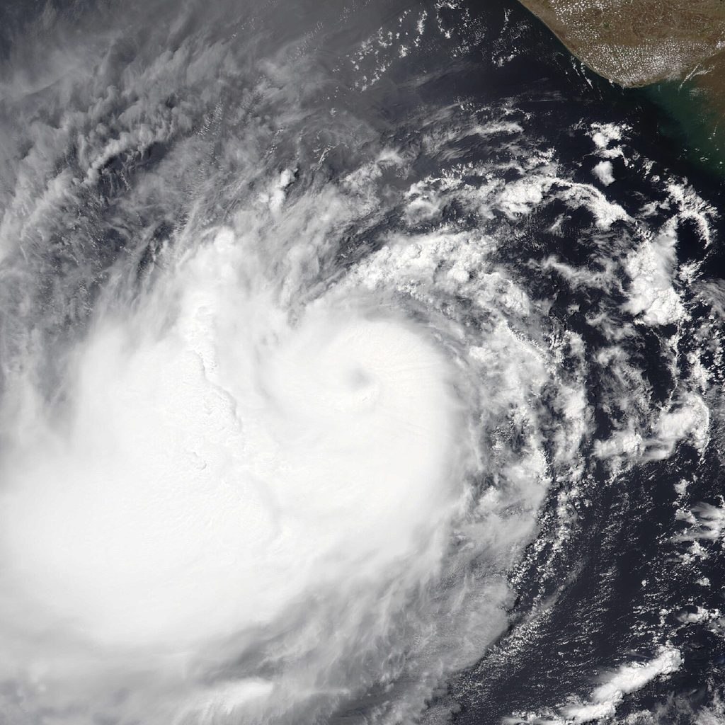
Overview
Cyclone Murasu, the ninth Bay of Bengal system of 2026 (BOB 09), formed as a Depression over the southeast Bay of Bengal at 1130 IST on 31 October 2026 near 10.0°N, 90.2°E, about 330 km west-southwest of Sri Vijayapuram. Moving west-northwestwards, it intensified into a Deep Depression and then Cyclonic Storm Murasu on 1 November, and into a Severe Cyclonic Storm over the westcentral Bay of Bengal on 2 November. Slowing to 8-9 km/h as it neared land, it crossed the south Andhra Pradesh coast between Nellore and Narsapur, close to Ongole (near 15.5°N, 80.2°E), between 0330 and 0530 IST on 3 November as a Severe Cyclonic Storm, with maximum sustained winds of 100-110 km/h gusting to 120 km/h, an estimated central pressure of about 995 hPa and IMD warning of a 1.0-1.5 m storm surge over Bapatla, Krishna and Prakasam districts. Bapatla recorded 22 cm of rain in the 24 hours to 0830 IST on 3 November. Over land it moved slowly north-northwestwards and was still a Severe Cyclonic Storm 40 km west of Bapatla at 1130 IST on 3 November; IMD forecasts it to weaken into a Cyclonic Storm that afternoon, a Deep Depression around midnight and a Depression by the morning of 4 November. The name Murasu was proposed by India and means "drum" in Tamil.
Timeline
Affected Areas
Key Statistics
District-Level Warnings
Valid from 8:30 am IST on 3 November to 8:30 am IST on 4 November, as Murasu weakened over land.
Source: IMD national bulletin no. 22 (1300 IST, 3 November 2026): Meteorological Centre Amaravati's Andhra Pradesh rainfall map and Meteorological Centre Bhubaneswar's Odisha map, both issued 3 November
Rainfall Recorded
Each figure is the rain measured at that place over about one day. Pick a day to see its exact time window.
Murasu came ashore close to Ongole (Prakasam), about 40 km southwest of Bapatla, between 0330 and 0530 IST on 3 November. The heaviest rain fell at Bapatla, just northeast of the landfall point, and further up the coast in West Godavari district.
Andhra Pradesh
Highest 220 mm · 14 places- BapatlaLandfall area3 Nov220 mmExtremely heavyReported by IMD as 22 cm
- NarsapuramWest Godavari district · 3 Nov200 mmVery heavyReported by IMD as 20 cm
- KaramcheduBapatla district · 3 Nov160 mmVery heavyReported by IMD as 16 cm
- AddankiBapatla district · 3 Nov150 mmVery heavyReported by IMD as 15 cm
- BheemavaramWest Godavari district · 3 Nov130 mmVery heavyReported by IMD as 13 cm
- OngoleLandfall areaPrakasam district · 3 Nov120 mmVery heavyReported by IMD as 12 cm
- RacherlaPrakasam district · 3 Nov120 mmVery heavyReported by IMD as 12 cm
- PalakoderuWest Godavari district · 3 Nov120 mmVery heavyReported by IMD as 12 cm
- BestavaripetaPrakasam district · 3 Nov110 mmHeavyReported by IMD as 11 cm
- SeetharamapuramSPSR Nellore district · 3 Nov110 mmHeavyReported by IMD as 11 cm
- AvanigadaKrishna district · 3 Nov80 mmHeavyReported by IMD as 8 cm
- Masulipatnam CDRKrishna district · 3 Nov80 mmHeavyReported by IMD as 8 cm, at the Machilipatnam cyclone detection radar station
- SanthamaguluruBapatla district · 3 Nov70 mmHeavyReported by IMD as 7 cm
- RepalleBapatla district · 3 Nov70 mmHeavyReported by IMD as 7 cm
Tamil Nadu
Highest 150 mm · 2 places- Kadapakkam2 Nov150 mmVery heavyReported by IMD as 15 cm, with no district
- Cuddalore3 Nov90 mmHeavyReported by IMD as 9 cm
Puducherry
Highest 70 mm · 1 place- Puducherry3 Nov70 mmHeavyReported by IMD as 7 cm, at each of two Puducherry stations
What the numbers mean
1 mm of rain is 1 litre of water on every square metre of ground. IMD grades a day’s rain like this:
- Extremely heavy204.5 mm or moreRivers can flood within hours; landslides likely in hilly areas.
- Very heavy115.6–204.4 mmWaterlogging, overflowing streams and disrupted roads are likely.
- Heavy64.5–115.5 mmWaterlogging in low-lying areas and slow traffic.
- Moderate15.6–64.4 mmA steady rainy day.
Source: IMD station observations: IMD national bulletin no. 22 (Annexure-1) and mid-day all-India weather bulletin of 3 November 2026, and IMD press release of 2 November 2026. IMD lists only stations with 7 cm or more. Provisional until IMD publishes its final report.