Cyclone Arnab: Landfall, Rainfall & Affected Areas (Sept 2026)
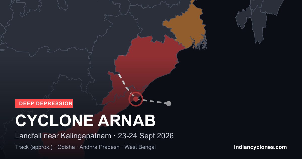
Quick answer: The Bay of Bengal system widely reported as “Cyclone Arnab” crossed the north Andhra Pradesh – south Odisha coast close to Kalingapatnam (Srikakulam) between about 11 pm on 23 September and 1 am on 24 September 2026. The India Meteorological Department (IMD) classed it as a Deep Depression throughout, so it was never officially named. Even so, it caused extremely heavy rain across south Odisha and north Andhra Pradesh, with rain spreading into south West Bengal.
Last updated 24 September 2026, evening. This page is a cross-check of IMD bulletins and reports by several major Indian news outlets. Where sources differ, we say so.
Is It Cyclone Arnab or a Deep Depression?
IMD grades systems by sustained wind speed, and a name is only given at cyclonic storm strength (62 km/h or more). This system stayed at Deep Depression strength (50–61 km/h sustained, with gusts to about 75 km/h near the coast), so IMD never named it. “Arnab” (Bengali for “ocean”, contributed by Bangladesh) was simply the next name on the list, which is why headlines and searches used it. Read the full explanation in Was Cyclone Arnab Really a Cyclone?
Cyclone Arnab Timeline
- 21 September: A well-marked low-pressure area over the Bay of Bengal became a Depression.
- 22 September: It intensified into a Deep Depression over the west-central and adjoining northwest Bay of Bengal, near 17.9°N, 86.3°E, moving west-northwestwards.
- 23 September, morning: About 140 km from Kalingapatnam and 150 km from Gopalpur. IMD forecast squally winds gusting to 75 km/h along and off the south Odisha – north Andhra Pradesh coasts until the evening of 24 September.
- 23 September, 2030–2330 IST: The centre was about 30 km west-southwest of Kalingapatnam, near 18.1–18.2°N, 83.9°E, crawling at 5–7 km/h. IMD said it would cross the coast within about two hours.
- Around midnight, 23–24 September: Landfall close to Kalingapatnam, between Visakhapatnam and Gopalpur.
- 24 September, 0530 IST: Over north coastal Andhra Pradesh, about 50 km west of Kalingapatnam and 80 km north-northeast of Visakhapatnam. IMD expected it to move northwest, hold Deep Depression strength for roughly 12 hours, then turn north-northwestwards and weaken over the next 24 hours.
Follow the latest position on our Active Systems page and our step-by-step IMD-based bulletins.
Cyclone Arnab Rainfall: District-Wise Totals
Rain, not wind, was the main hazard. The figures below are 24-hour totals reported from IMD observations. They were compiled from several outlets, and exact figures and spellings vary slightly between reports and observation times, so use them as indicative and check IMD for official data.
| State | Station (district) | Rainfall |
|---|---|---|
| Odisha | Semiliguda / Similiguda (Koraput) | about 230 mm, the highest reported |
| Odisha | Chitrakonda (Malkangiri) | about 168 mm |
| Odisha | Jeypore (Koraput) | about 161 mm |
| Odisha | Tangi (Khordha) | about 142 mm |
| Odisha | Borigumma (Koraput) | about 138 mm |
| Odisha | Tentulikhunti (Nabarangpur) | about 138 mm |
| Odisha | Badamba (Cuttack) | about 134 mm |
| Odisha | Kalimela (Malkangiri) | about 127 mm |
| Odisha | G. Udayagiri (Kandhamal) | about 125 mm |
| Odisha | Paralakhemundi (Gajapati) | about 121 mm |
| Andhra Pradesh | Palasa (Srikakulam) | about 141 mm, the highest in the state |
| Andhra Pradesh | Sompeta (Srikakulam) | about 135 mm |
| Andhra Pradesh | Kalingapatnam, Tekkali, Araku Valley | about 120 mm, 110 mm, 100 mm |
| West Bengal | Kansabati Dam (Bankura) | about 100 mm, the highest in the state |
| West Bengal | Medinipur, Panagarh, Contai, Darjeeling | about 94 mm, 87 mm, 55 mm, 55 mm |
Cyclone Arnab Affected Areas
Odisha: Koraput, Malkangiri, Gajapati, Ganjam, Puri
South Odisha bore the brunt. IMD red warnings for heavy to very heavy rain with extremely heavy falls at isolated places covered Koraput, Malkangiri, Nabarangpur and Kalahandi, and earlier Gajapati and Ganjam. Puri was placed in a red zone for the following two days and sea bathing was banned. Schools were closed across many districts, including Koraput through 25 September, and ferry services on Chilika were suspended. Gajapati has about 140 identified landslide-prone spots; one landslide was reported there with no injuries. See Odisha’s cyclone history.
Andhra Pradesh: Srikakulam, Visakhapatnam, Vizianagaram
Srikakulam took the landfall, with heavy rain also in Visakhapatnam, Vizianagaram, Alluri Sitarama Raju and Anakapalli, and flooding reported in low-lying parts of Vijayawada. Schools and Anganwadi centres were shut in Srikakulam and Vizianagaram. See Andhra Pradesh cyclones.
West Bengal: Kolkata, Howrah, Bankura, Darjeeling
As the system moved inland, IMD issued an orange alert for Kolkata, Howrah, South 24 Parganas, Bankura, Purulia, Birbhum and West Bardhaman, with rain forecast through 26 September and landslide warnings for Darjeeling and Kalimpong. Fishermen were advised to stay off the sea along the West Bengal and Odisha coasts until Friday. See West Bengal’s cyclone record.
Evacuations, Deaths and Damage
- Evacuations: More than 5,000 people were moved to cyclone shelters in Gajapati, including pregnant women and older residents. One live blog reported 8,082 people evacuated out of 8,205 affected across six Odisha districts as of the afternoon of 24 September.
- Response: Odisha deployed 33 ODRAF teams, 24 in vulnerable districts and 9 in reserve.
- Deaths: Most reports we reviewed listed no deaths. One live blog reported a single fatality from a house collapse in Remuna, Balasore, and one child injured. We have not seen this confirmed in an official statement, so treat it as unconfirmed. We will update this page as official figures are released.
Where Sources Differ
- Landfall time: IMD forecasts pointed to the night of 23 September; press reports place the crossing between about 11 pm and 1 am. One outlet gave a specific 2:47 am time that we could not match to an IMD statement, so we do not use it.
- Rainfall: Reports use different observation windows and spellings (Semiliguda / Similiguda), and give both cm and mm.
- Evacuations: Figures range from 1,500 to more than 5,000 for Gajapati alone, depending on the time of the report.
What Happens Next
IMD expects continued weakening over land and heavy rain across coastal Andhra Pradesh, Odisha and West Bengal through 26 September. Avoid low-lying and waterlogged areas, stay away from shorelines, and follow your district administration’s advisories. Our guides on preparing for cyclones and IMD colour-coded warnings explain what each alert means. For comparison with stronger storms on the same coast, see Titli (2018) and Phailin (2013).
Frequently Asked Questions
Was Cyclone Arnab a real cyclone?
No. IMD classified the system as a Deep Depression from 22 September through landfall. It never reached cyclonic storm strength (62 km/h sustained wind), so it was not officially named. Arnab is the next name on the North Indian Ocean list, and many news outlets used it in headlines.
Where and when did the Cyclone Arnab system make landfall?
It crossed the north Andhra Pradesh and adjoining south Odisha coast close to Kalingapatnam in Srikakulam district, between about 11 pm on 23 September and 1 am on 24 September 2026.
Which areas were most affected by Cyclone Arnab?
Koraput, Malkangiri, Nabarangpur, Kalahandi, Gajapati, Ganjam and Puri in Odisha; Srikakulam, Visakhapatnam and Vizianagaram in Andhra Pradesh; and south West Bengal districts including Bankura, Paschim Medinipur, Kolkata and Howrah.
How much rain did the Cyclone Arnab system bring?
The highest reported 24-hour total was about 230 mm at Semiliguda in Koraput, Odisha. Jeypore recorded about 161 mm and Palasa in Srikakulam about 141 mm. Kansabati Dam in Bankura, West Bengal, recorded about 100 mm.
Will the name Arnab be used for a future cyclone?
Yes. Because this system was never named, Arnab remains the next name on the list for the next North Indian Ocean cyclone that reaches cyclonic storm strength.
Sources
Official: IMD / RSMC Tropical Cyclones New Delhi bulletins and posts, 23–24 September 2026 (mausam.imd.gov.in). News reports compared: The Week, India TV, ETV Bharat, India.com, Pragativadi and Time News. All text is our own summary; no third-party images are used.