How Do Tropical Cyclones Form?
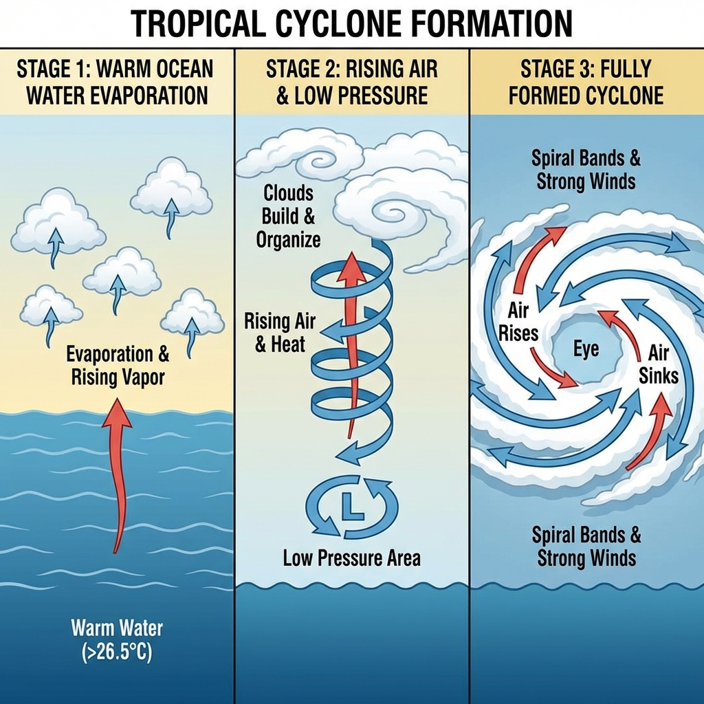
The Perfect Storm: Conditions for Formation
Tropical cyclones don't just appear out of nowhere. They require a specific set of conditions to form and intensify. In the Indian Ocean, these conditions are most commonly met during the pre-monsoon (April-June) and post-monsoon (October-December) seasons.
Essential Ingredients
- Warm Ocean Water: Sea surface temperatures must be at least 26.5°C (80°F) to a depth of about 50 meters
- Atmospheric Instability: Warm, moist air must be able to rise rapidly
- Low Wind Shear: Minimal difference in wind speed and direction at different altitudes
- Coriolis Effect: Sufficient distance from the equator (at least 5° latitude) for rotation
- Pre-existing Disturbance: A weather system to organize the convection
The Formation Process
Stage 1: Tropical Disturbance
It begins with a cluster of thunderstorms over warm ocean waters. Warm, moist air rises, creating an area of low pressure at the surface. More air rushes in to fill this void, and the process begins to organize.
Stage 2: Tropical Depression
As the system becomes more organized, wind speeds increase to 31-61 km/h. The Coriolis effect causes the system to rotate - counterclockwise in the Northern Hemisphere (which includes the Bay of Bengal and Arabian Sea).
Stage 3: Tropical Storm
When sustained winds reach 62 km/h, the system is classified as a tropical storm and receives a name. The eye begins to form as the storm continues to intensify.
Stage 4: Tropical Cyclone
At wind speeds exceeding 118 km/h, the system becomes a tropical cyclone. The eye becomes well-defined, surrounded by the eyewall - the most intense part of the storm.
Why the Indian Ocean is Special
The Bay of Bengal is one of the most cyclone-prone regions in the world. Its unique geography - a semi-enclosed basin with warm waters - creates ideal conditions for rapid intensification. The Arabian Sea, while less active, can also produce powerful cyclones.
The Role of Climate Change
Recent research suggests that while the total number of cyclones may not increase significantly, the intensity of the strongest storms is likely to increase due to warming ocean temperatures. This makes understanding cyclone formation more critical than ever.
Conclusion
Understanding how cyclones form helps us better predict their behavior and prepare for their impacts. While we can't prevent these natural phenomena, knowledge empowers us to minimize their devastating effects on coastal communities.