Cyclone Arnab? Bay of Bengal Deep Depression Makes Landfall in Andhra Pradesh (September 2026)
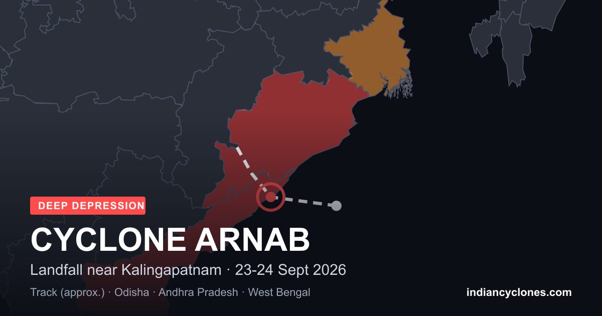
Unconfirmed name notice: as of this update, IMD has classified this system only as a Deep Depression. It has not been named. “Arnab” is the next name on the WMO/ESCAP North Indian Ocean naming list and would only apply if the system is later upgraded to a cyclonic storm. Treat every mention of “Cyclone Arnab” on this page as a forecast possibility, not a confirmed storm name, until IMD says otherwise.
Update, 24 September: Landfall Has Happened
The system crossed the north Andhra Pradesh coast near Kalingapatnam (Srikakulam) between about 2300 IST on 23 September and 0100 IST on 24 September, still as a Deep Depression. At 0530 IST it lay about 50 km west of Kalingapatnam and 80 km north-northeast of Visakhapatnam, and IMD expects it to weaken gradually over land during the next 36 hours. Heavy rain continues over Andhra Pradesh, south Odisha and south West Bengal through 26 September. It was never upgraded to a cyclonic storm, so “Arnab” has not been used and remains the next name on the list. See our landfall bulletin for details.
The sections below are kept as originally published on 22 September.
What Was Happening on 22 September
A system over the Bay of Bengal has strengthened from a Well Marked Low Pressure Area to a Depression and then to a Deep Depression over 21-22 September 2026. As of the morning of 22 September, it was centred near 17.9°N, 86.3°E in the west-central Bay of Bengal, moving west-northwestwards at about 17 km/h. IMD's forecast track points toward the north Andhra Pradesh-south Odisha coast, with landfall likely around the morning of 23 September near the Srikakulam-Chhatrapur (Ganjam) stretch.
Squally winds of 55-65 km/h, gusting to 75 km/h, are forecast over the west-central and adjoining northwest Bay of Bengal, with heavy to very heavy rainfall expected over coastal Andhra Pradesh, Odisha, Chhattisgarh and Telangana as the system moves inland. Follow the full live data, forecast track and district-level warning map on our Active Systems page, which updates as new IMD bulletins are issued.
Why the Name “Arnab” Is Being Searched
Tropical cyclones in the north Indian Ocean are named from a rotating list maintained by IMD on behalf of thirteen WMO/ESCAP member countries, each of which contributes names in turn. The next name due to be used, if this or a future system is upgraded to cyclonic storm intensity, is Arnab — proposed by Bangladesh, meaning “ocean” or “sea” (from the Sanskrit arnava). That is why searches for “Cyclone Arnab” are appearing even though no storm has officially been named yet: people are searching ahead of the naming, not after it.
IMD only assigns a name once a system's maximum sustained wind reaches cyclonic storm strength (about 63 km/h). The current system is a Deep Depression, below that threshold, and IMD's own guidance for this system does not forecast further intensification to cyclonic storm intensity. It may make landfall without ever being named at all — that has happened before with Bay of Bengal depressions.
How This Compares to Past Storms
This system is intensifying on a similar late-September to October timeline as several storms already in our cyclone archive, including Titli (2018) and Phailin (2013), both of which also affected the Andhra Pradesh-Odisha coastline. For background on how IMD's naming and classification system works, see our explainers on how IMD classifies cyclones and how IMD cyclone warnings work.
Where to Get Verified Updates
- Live position, forecast track and district-level colour-coded warnings: Active Systems
- This system's full record, updated as new bulletins arrive: Unnamed System (Bay of Bengal), September 2026
- Official source: RSMC Tropical Cyclones New Delhi / India Meteorological Department (IMD)
We will update this page and the Active Systems page as IMD issues new bulletins. If the system is upgraded and officially named Arnab, that confirmation — and only that confirmation — will be reflected here as fact.